
During the four months I spent in Deming, New Mexico, I experience many things, from stargazing to walking tours, from sip-and-paint to spending time with friends. I already wrote about checking two items off the bucket list while there. A post or two about my time in Deming is forthcoming. But I took so many photos of my day at the Gila Cliff Dwellings, it begged for its own post just so I could share some of the many photos I took.
From Deming, it was a three hour drive each way. GPS might tell you something different in terms of how long it will take to get there but don’t believe it. The drive is up a mountain road that is quite windy which means slow driving. I went in the winter so I hit many patches of ice on the road.
Interestingly, I passed a few campgrounds along the way. I didn’t think it would be that fun to drive an RV up but it can be done. As near as I could tell, all of them were dry camping in National Forest lands.
I stopped at the Visitors’ Center first. Okay, well actually, I drove past the turnoff to the Gila Cliff Dwellings and stumbled on the Gila Cliff Dwellings Visitor’s Center a few miles down the road. But I sound so much more with-it if I say I planned to go the Visitors’ Center first. It actually turned out to be a good accident.
The Visitors’ Center, while small, had a film about the cliff dwellings and the people who inhabited them 700 years ago. It was wonderful. Plus, it gave me a chance to pick up postcards. I also learned to pronounce the dwellings correctly. HEE-la. The G sounds like an H.
Visiting the Gila Cliff Dwellings
Once I got myself oriented and the ranger staffing the Visitors’ Center gave me instructions to get to the proper parking lot, I was off. It wasn’t hard. Basically, just don’t miss the turnoff.

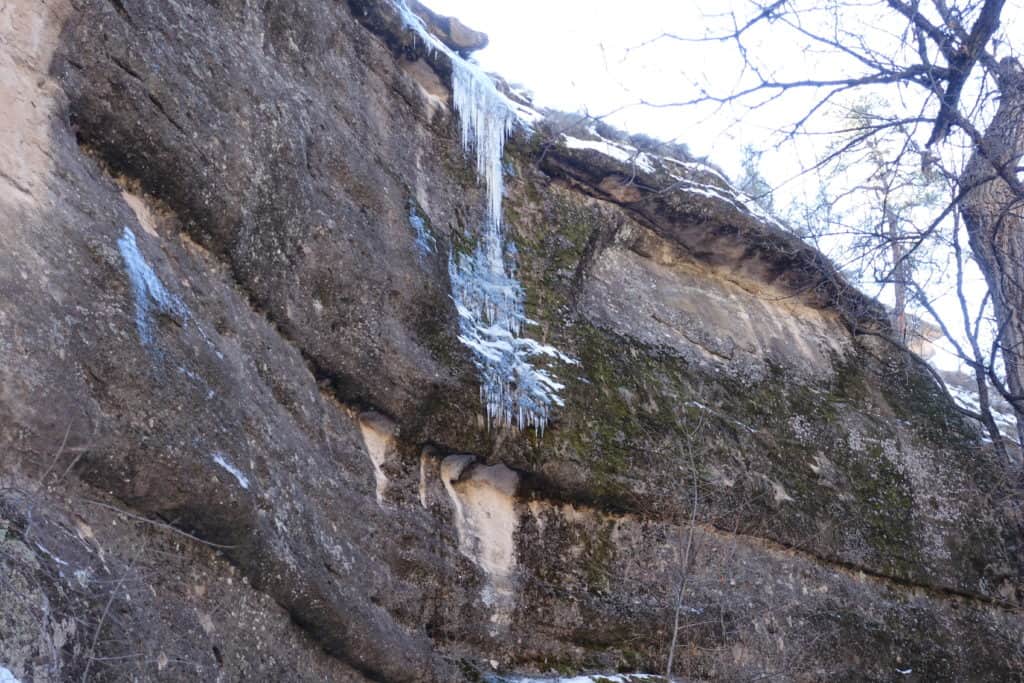
After talking to the ranger, who busied herself breaking up a big patch of ice, at the base of the mountain, I decided to take my hiking poles. While they warn that the trail is unpaved, steep in places and uneven, most of the time I doubt you’d need hiking poles. But I took them because, just like the road up, the shaded places on the trail were icy. The places where the sun hit the trail were muddy. During the heat of the summer, it would be advisable to take a little water with you.
All that said, I think most people could probably go. Obviously, it is not ADA accessible. When you get to the dwellings, you don’t necessarily have to go climbing up into them. There are lots of benches on the trail up for resting. Plus, the trail is a loop so even though it is one-person wide, you won’t have to step aside for anyone going the opposite direction. The loop is a mile and they say to plan on it taking at least an hour.
Once a day during the summer months, they offer a guided tour which I bet is awesome. But between the film and the brochure, you’ll still learn a lot. The really cool thing about going in winter, despite the cold and ice, I experienced the dwellings alone most of the time. Made it easier to imagine life there and made for better photos.
Gila Cliff Dwellings Tour

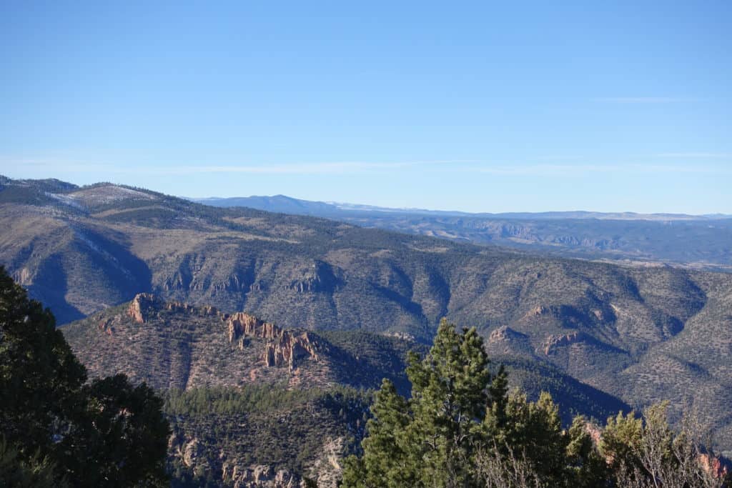
Since it was winter, the scenery up wasn’t very pretty so I didn’t take many photos. Plus I was concentrating on my footing. Still, I bet other times of year when things are green, the walk up would be pretty.
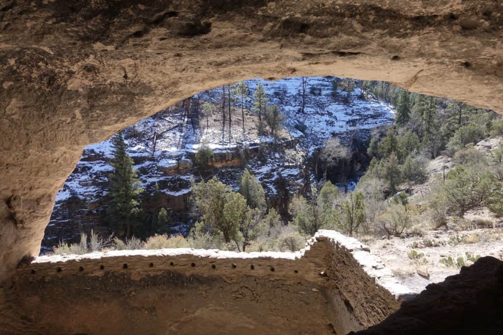
The Gila Cliff Dwellings are at the top of one side of a canyon. The Gila River runs through the canyon. In this area (desert southwest), water is precious. Easy access to a water source is one reason this location was perfect for the early people. Plus, the water was utilized by animals they could hunt.
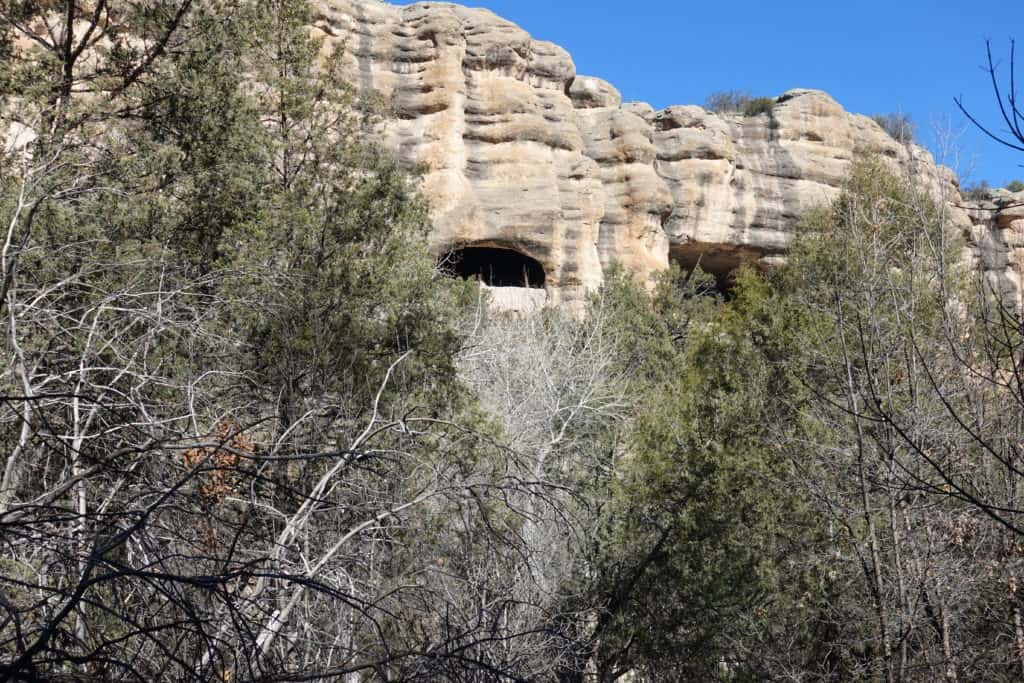
Interested in geology? Let me share how these were formed. About 28 million years ago, the area was a giant volcano which erupted. It shot ash and shards of volcanic glass into the sky. It fell back to the ground, still hot, and welded together into a stone called tuff. Then later volcanoes erupted spreading lava over the tuffs, escaping gas from the lava left the holes in the rock. Then the long process of erosion began and the river carved out the canyon.

Although there are a few theories, the truth is scientists don’t know the purpose or meaning of the t-shaped doors which are not only found at Gila, but all over the southwest.

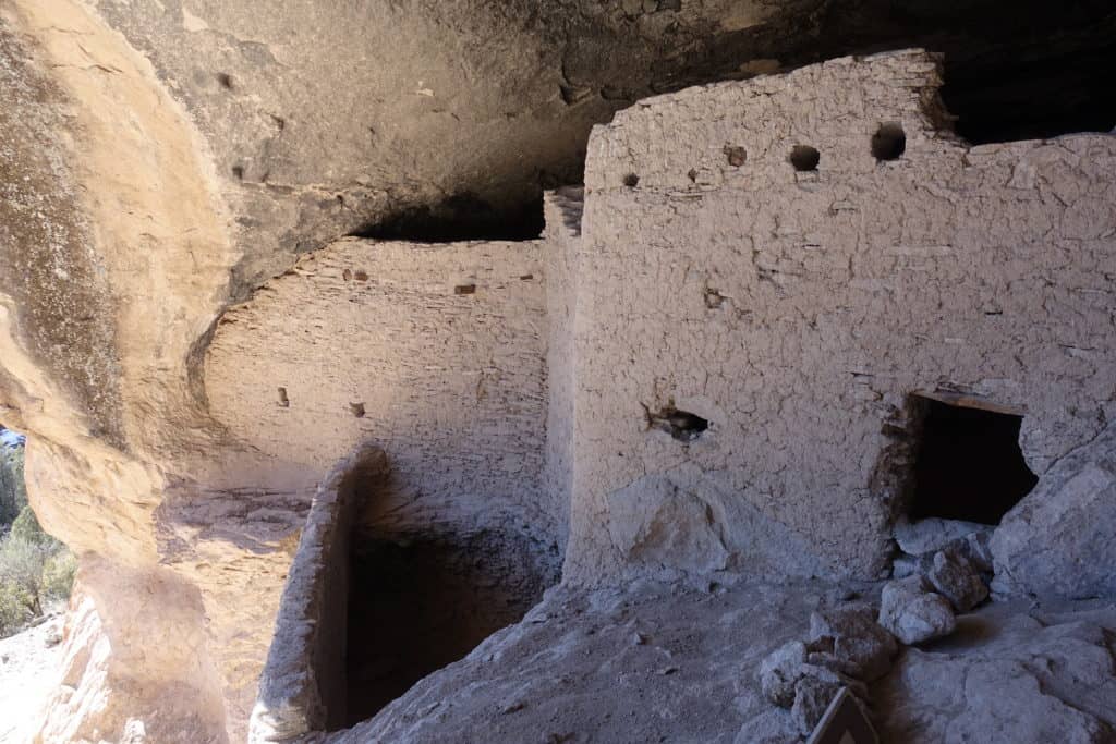
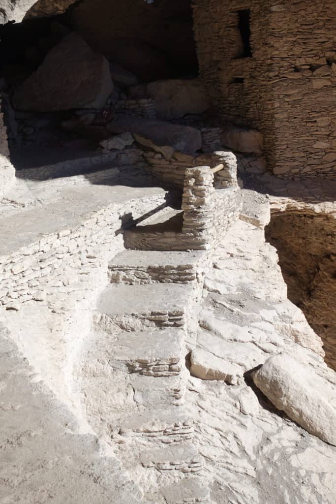
Many ancient people used the caves as shelter, but the Mogollon (a prehistoric Native American peoples) built rooms within the caves. They spent five years turning the place into their home. Interesting, they only lived in them for 25 years or one generation.
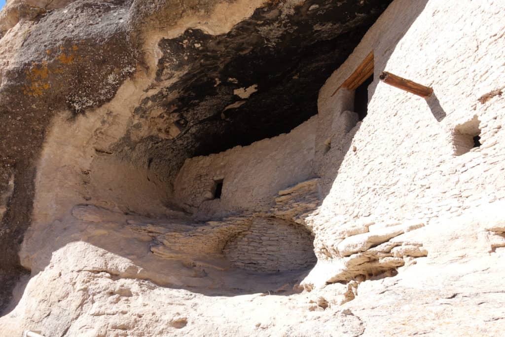
If you are wondering how archaeologists know that the Mogollon people lived in the caves 700 years ago, let me tell you what I learned. The roofs of the rooms are no longer present. However, wooden poles overhead are. Dating the trees by studying ring patterns, they know most of the rooms were built in the 1280s.


Final Thoughts
I didn’t take photos on the way down the mountain. That side of the mountain experienced a fire (in 2013, if I remember correctly what the ranger said when I asked). As fires do, it left the mountain charred and not very photogenic. Plus, just like on the way up, I needed to concentrate on my footing so as not to ice skate my way down.
If you haven’t heard of the Mogollon people, you wouldn’t be alone. Turns out the Mongollon culture disappears from archaeological record in the 1400s (only 100 or so years after they abandoned the Gila Cliff Dwellings). However, the Mongollon people didn’t disappear. Their descendants are part of modern-day Pueblo cultures of the area.
Speaking of the Mongollon people and culture. You might find it interesting that Gila Cliff Dwellings is the only place in the National Parks Service that highlights the Mongollon. As part of this, they work to interpret, perserve and share this wonderful National Monument.
By the way, it was declared a National Monument in 1907 by President Theodore Roosevelt.
Links to Relevant Posts:
To see products recently purchased by readers or to browse and shop at Amazon, follow either of these links. Huge thanks for your support.
Affiliate Link Disclosure. As a result of being an Amazon Affiliate, I earn from qualifying purchases.


Hi Debbie, I visited the Gila Cliff dwellings in 2015 and lived in New Mexico from 2015-16. I love that part of the country with all the history. I have a friend that lives in Deming and I hope to move back to New Mexico in a few years when I retire. Thank you for bringing back some good memories and for sharing your adventures with us.
Thanks, Julie. Glad I did justice to the place. It was so fun and super interesting. I was surprised by how much there was to do in the area, considering Deming is a pretty small town. It would be a nice place to land at retirement. I met a couple of people who retired in the area (from Michigan if I remember right) because of the climate and the night sky. They were amateur astronomers.
Super pretty pictures. Did you think of dragging a blanket in there & sleeping overnight to see the real experience of how they lived? (-::
Well, I could see the appeal of the place. Protected from the elements, near water. And I liked imagining what it might be like but not sure about overnighting in there when it was getting down into the 30s at night.
Looks like a fun adventure! I like the pictures looking out from the dwellings too. 🙂
Yeah those one are where you can really put yourself in the place of the people who lived there. Glad you liked the post.
Hi Debbie – I enjoyed this – thanks! Wish I had taken that in last fall! I wonder how these compare to the cliff dwellings in Colorado. Take care!
Oh, I didn’t know there were cliff dwellings in Colorado. I’ll have to make a point to visit those so I can compare the two. If you make it back to Balloon Fiesta, this is definitely a worthy side trip.
Wow! Amazing! I bet that was exciting going into a place where someone years ago actually dwelled. I would love to see how the interior looks lit up by a warm fire. Enjoyed the content.
Thanks, Nancy Jo. Yeah, I would love to see that too. Can’t you just imagine it all glow-y? And how fun to make hand puppets on the wall.
Thank you for taking me on another wonderful adventure!! The pictures are beautiful. I wish the historians new why the doors were T shaped. I am glad Alabama is keeping the state parks open and you have a place to park your rig. Be well. Love, Marie